blah blah blah
Red Hill
Length: 3.8 mile loopDifficulty (click for info): Easy
Elevation Gain: 1350 feet
Rating (click for info): 7/10
Elevation: 2030'
Prominence: 1380'
Driving Directions:
Parking is on Red Hill Road in Moultonborough, NH. Take Bean Road from the north side of Rt. 25, 150 feet north of the junction of Rt. 25 and Rt. 25B in Center Harbor. Go 1.5 miles, then turn right onto Sibley Road. Continue 1.1 miles and turn left onto Red Hill Road. The parking area is on the right in 0.2 miles. If there is no space to park, drive up the path to the smaller upper parking area. Click here for a Google map.
About the Hike:
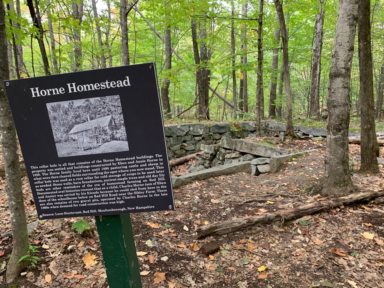
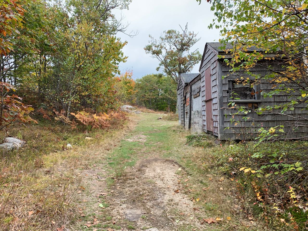
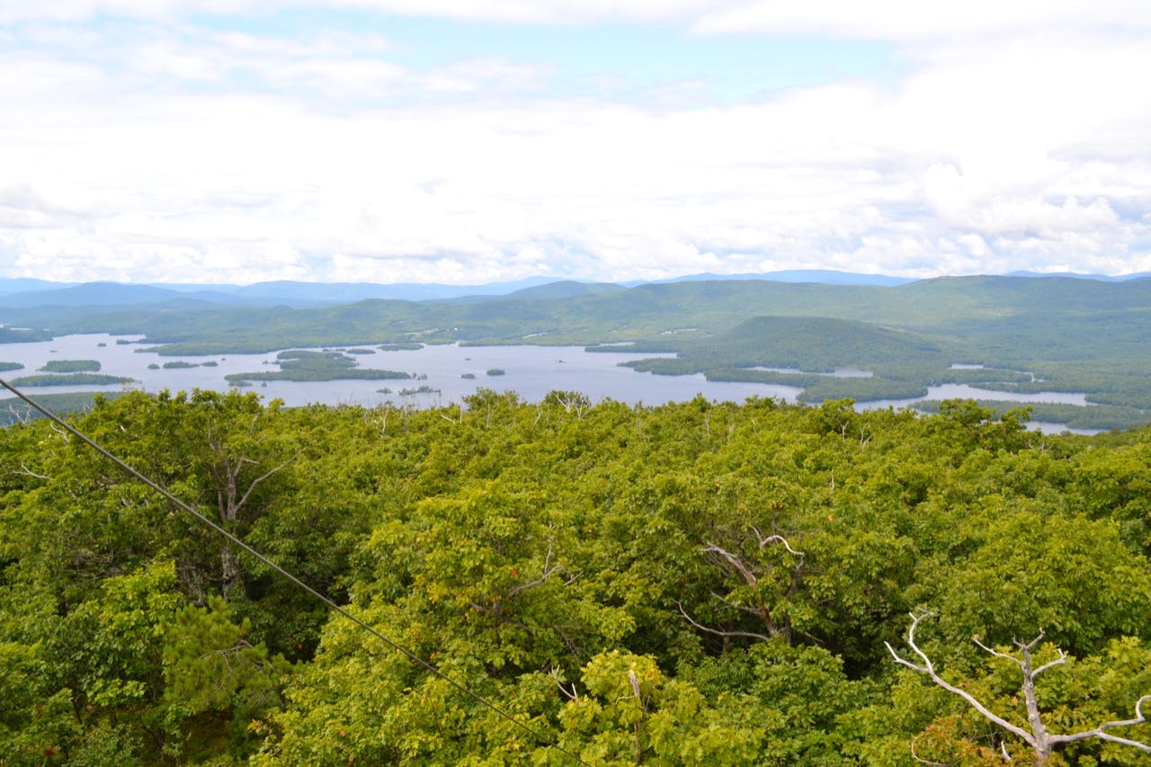
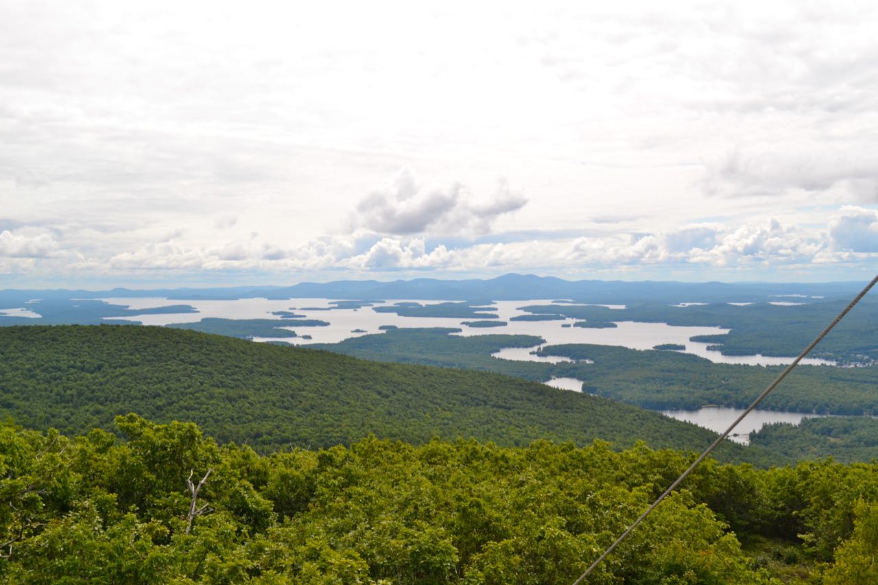
Red Hill is the dominant natural feature between Lake Winnipesaukee and Squam Lake. The fire tower on its cleared, grassy summit commands panoramic views of both lakes from relatively nearby. The hike is entirely on a mostly gradual old jeep road, maintained by the Lakes Region Conservation Trust, and the summit has a large grassy clearing with historical buildings and a picnic table. To begin your hike, walk up to the upper parking area and over to the LRCT kiosk. Red Hill Trail leaves right behind the kiosk and starts out with a gradual meander through the woods. In 0.15 miles, the trail dips to cross a gullied-out woods road. In another 0.15 miles, it crosses a brook on a wooden bridge and climbs up a wide, rocky section. Another old road joins from the right, and after a third 0.15-mile segment, the trail passes through a wooden fence and reaches another kiosk with a trail map. Turn left to stay on Red Hill Trail and stop to read a historical marker about a cellar hole on your left. Now following the old fire warden's jeep road, the trail makes a long, winding climb up the mountainside over rocky footing, staying within a small brook valley (the brook is on the left side, always out of sight of the trail). It eventually swings out and onto a small ridge for a bit, then returns to the brook valley with many short zig-zags. After 0.7 miles from the kiosk, the trail takes a sharp left out of the brook valley and becomes gentler. The trail traverses some nice open forest for the final easy 0.4 miles to the summit. You will pass Eagle Cliff Trail on the left at another kiosk, then emerge in the summit clearing.
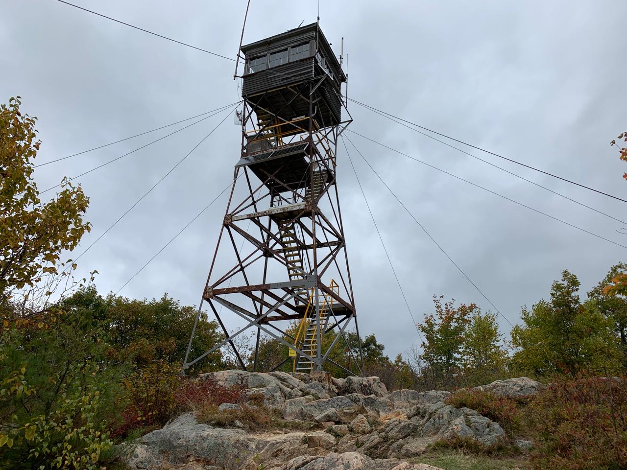
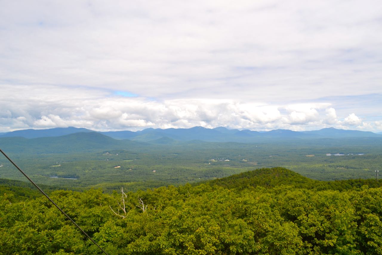
You will pass the fire warden's cabin and come to one picnic table in front of a limited cleared view to the south. The tower is on the other side of the clearing, with the summit benchmark on a ledge behind it. From the tower deck, there is a wonderful view in all directions, encompassing the Belknap, Osipee, and Squam Ranges around the extensive lake country; the Sandwich Range looms to the north, with the pinnacle of Mt. Chocorua in full view. The tower also has a good view of the towns and small ponds in the valleys below. In particular, there is a good view of the towns of Sandwich to the north and Center Harbor to the south. After enjoying the view from the tower, begin your loop descent by heading over to the sign for the Cabin Trail, near the base of the tower. The trail heads down into the woods and descends moderately off the summit for 0.1 miles, then heads across a small plateau and passes through a clearing. It begins descending again in another 0.1 miles and heads down the slope in a winding course for 0.6 miles to the col between Red Hill and its southeast peak, where it passes by the trail's namesake cabin. It turns and begins descending more gradually, now following the old road that you began your hike on. Not far past the cabin, look for a spur trail on the left leading to another historical site - the Cook homestead. The spur trail forks, with the right fork leading a few steps to the cellar hole of the Cooks' barn and the left fork going about 0.1 miles to the cellar holes of their houses. Just past the spur trail on the main trail is an informative sign explaining the backstory of the Cook family. Cabin Trail continues down the road, which becomes wider and rockier as it descends gradually for half a mile back to the loop junction at the kiosk. Return through the fence and bear right to head back the way you came to the parking area.
Printable directions page